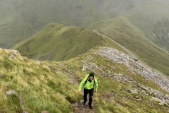
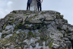
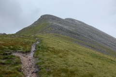
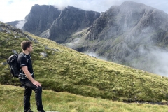
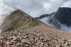
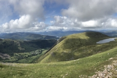
On Friday Jay and I hiked Stob Ban in the Mamores and traversed its ridge across to its westerly neighbour Mullach nan Coirean to create a fun medium length circuit. The weather was extremely windy with some rain as we hiked up Stob Ban, making sure to take extra care and turn around if it ever got too dangerous. We met a few other people all coming down after turning around due to the weather. We continued on past them and eventually climbed the final ridgeline ascent to the summit. The wind was being funnelled up the valley and over this last ridgeline, creating a howling vortex trying to blow us off the mountain. We crouched low to the ground and half crawled our way to the top all the while the wind whipped pellets of stinging rain into our faces and exposed skin.
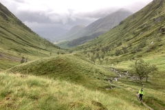
The temperature as we got to the top was down around zero so we found a sheltered spot to gobble down a couple of snack bars and admire the view before continuing our traverse across to Mullach nan Coirean. We ran some of the top to keep our temperatures up, the whole time using one hand to shelter our eyes from the projectile rain and battling the wind trying to blow us away. We made it easily to Mullach nan Coirean and began to descend down into a back valley which would loop us back around to the road and then to the trailhead. The wind down this back ridge was more intense than anything we had yet experienced. Luckily the rain had eased off and the ridgeline was wide and meandering rather than steep and narrow like the ascent. We alternated between pausing, holding onto rocks or crouching down while the wind gusted and then bouncing along again like tumbleweeds blown in the wind. The wind shifted from blowing across our pathway, pushing us off the trail to being at our backs and rapidly propelling us downwards.
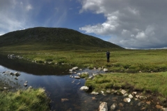
The last stretch before the carpark was shin deep water and mud, squelching through the bog and running water from all the rain. We were already soaked by this time so no care was taken to stay out of the water, rather just finding the most direct route down. We were out of the wind for this part and soon we were back at the carpark after what seemed like 4hrs of battling nature on this crazy Scottish mountaintop. The Scottish highlands have not disappointed so far. Their fierce beauty has already left a lasting impression, making a return trip inevitable.
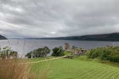
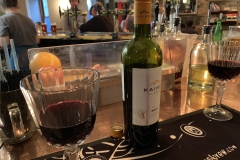
That afternoon we went back to the hotel for a shower and to try and clean/dry some of our gear before jumping in the car and heading north to visit Loch Ness in search of the elusive Loch Ness Monster. Home again to Fort William and a steak dinner with red wine capped off the evening in preparation for Ben Nevis on Saturday.
| Total Distance | 13.72km |
| Ascent | 1,295m |
| Total Time | 3hrs 55min |
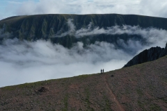
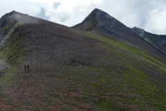
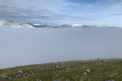
Saturday turned out to be a stunning day and we arrived at the trailhead for Ben Nevis at 8am. There are multiple routes to reach the summit and so with the weather as perfect as it was, we decided to take the best and most difficult (although it didn’t turn out to be particularly hard) which follows the ridgeline from Carn Mor Dearg arete across to the Ben Nevis summit. It included some scrambling and crossing two Munros (Scottish name for mountains over 3000ft). Initially some small sections of cloud blew across us as we began our ascent and we couldn’t stop for very long at any one time because the midges were out in absolute force but we soon emerged above the cloudline and looked acoss into the valley beside the back of Ben Nevis. There was a bank of cloud sitting in the valley against the ridge between Carn Mor Dearg arête and Ben Nevis waiting for the sun to burn it off and we crested the first Munro to then make our way along the narrow ridge to the back-side of Ben Nevis. The last few hundred meters were tough as the sun baked down on your backs but we eventually made it to the top to a whole host of people also making the most of the good weather, although they’d all hiked up the easy front way.
We marvelled at the views (although none as good as while climbing the route we’d taken) and took a few snaps before having lunch and making our way back down. Coming down the popular front route was mostly a wide switchback pathway created with local rocks, plenty of people were going in both directions so we jogged and skipped along at a steady pace overtaking everyone before the route back to our car branched off in a different direction. Trudging through the bog and then down through a field, making our own trail as we couldn’t see one through the water and mud, took us back to the river and then it was only a short couple of kilometres back to the car. A splish, splash in the feezing cold shallow creek and we were in the car on the way back to Glasgow.
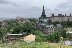
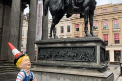
We then spent the night and the next day in Glasgow, exploring the centre of the city, a cathedral, necropolis and the Glasgow Museum of Modern Art with some delicious pancakes for breakfast before flying back to London.
| Total Distance | 18.85km |
| Ascent | 1,785m |
| Total Time | 6hrs 32min |


